Lechlade is a pleasant small market town standing on the north bank of the River Thames. Except for very small craft, it marks the limit of navigation, and in consequence it was nearby that the Thames & Severn Canal began its
journey across the Cotswolds to link up with the Severn. A popular tourist destination now, Lechlade was unfortunately some distance from the station, and tourist traffic probably suffered as a consequence. Ironically, since closure, the town has grown out to meet the station! As
Kelmscott & Langford station had not opened at the time, Lechlade station featured in the funeral arrangements for William Morris in 1896, the coffin being taken to Kelmscott from Lechlade on a specially prepared farm wagon.
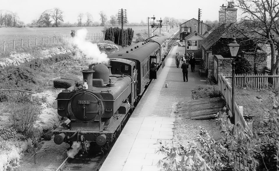
57xx Class 0-6-0PT 9653 waits at Lechlade with a two coach train for Fairford in early 1961. The guard in his Hawksworth bow ended coach gives the 'right away' to the driver, who is not taking any notice
as he is watching the photographer! Martin Loader Collection
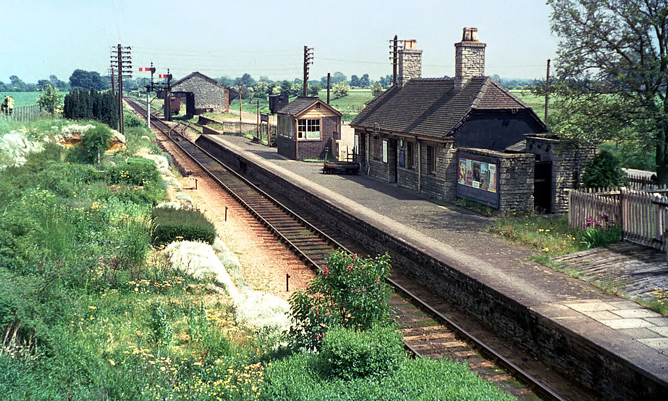
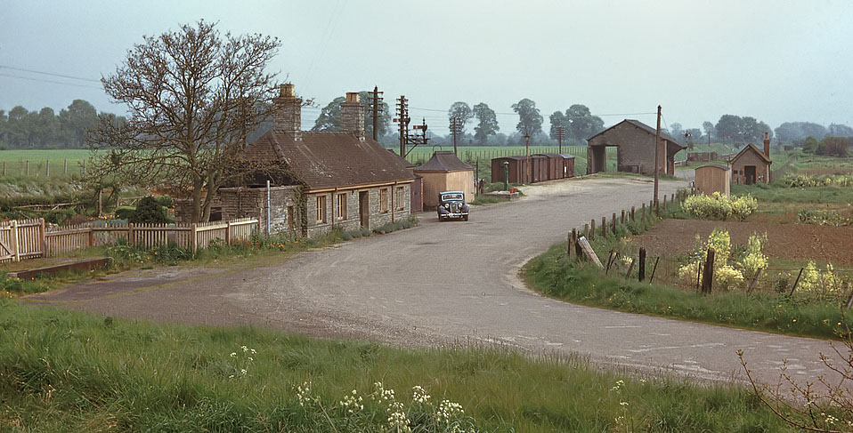
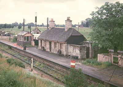
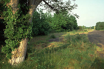
Lechlade station (SP218006) was situated next to the A361 road just to the north of the town and was 18 miles 38 chains from Yarnton Junction. Standard EGR buildings were provided
along with a GWR signal box. Although a passing loop was added during the Second World War, this was only for the use of freight trains. It can just be seen in the background of this early 1960s view. Note also a wagon
standing on the overgrown long back siding to the left of the signal box. The field on the left was
later used for gravel extraction, and is now a popular fishing lake.
Paul Strong
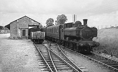
57xx Class 0-6-0PT 3722 passes Lechlade goods shed with a train bound for Oxford in the late 1950s. There was obviously still a little goods traffic being handled at this late date, as
a line of wagons are visible in the goods shed siding. 3722 had moved from Oxford to Newport (Ebbw Junction) by late 1960, and was withdrawn from there in May 1962, and was scrapped at Cashmores of Newport the following
November.
Paul Strong
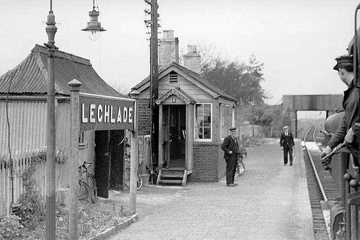
The fireman of an Oxford to Fairford train is about to hand the train staff to the Lechlade signalman in this 17 April 1959 view. A couple of the signal levers can be glimpsed
through the open signal box door. The typical flood under the cheaply
built EGR bridge is evident in this picture, while in the distance, the down advanced
starter signal can just be seen, placed on the north side of the line. In the far distance the line can be seen disappearing under Bridge
No.26.
Martin Loader Collection
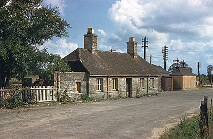
An excellent view of the station approach road taken in the early 1960s. From left to right we can see: the gates giving access to the platform for the loading of milk churns, the
station building, standard GWR pagoda hut, goods shed, corrugated iron store, with the isolated cattle dock behind, and the weighbridge hut. As can be seen, the field to the south of the station was used for
allotments. Note the elm trees in the background, a once familiar sight in the area until the ravages of Dutch Elm Disease in the late 1960s changed the landscape for ever. The original Kodachrome slide shows plenty of
detail, including a PW hut in the far distance, and the famous topiary hen in the gardens opposite the platform. This can just be seen through the branches of the tree by the station building. Colour Rail
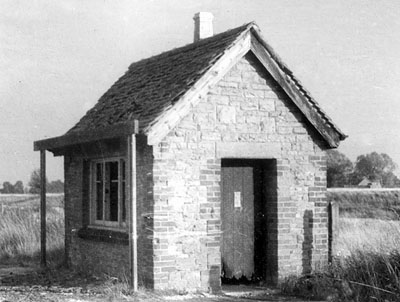
A poor quality image, but one that shows Lechlade's weighbridge hut in close up. Note the structure in front of the window, designed to prevent road vehicles from damaging the building. This is a post closure view, which explains why
most of the tiles have slid off the roof. It is clear from the background of this picture that the station site sat at a lower level than the surrounding countryside. The difference in level is indicated by a grassy bank. Martin Loader Collection
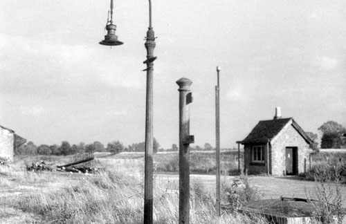
Another poor quality post closure view, looking towards the weighbridge hut from the platform, with one of the posts of the running in board in the centre of the picture. The corner of the goods shed can just be seen on the extreme left.
In the right foreground is what appears to be a concrete topped diesel fuel tank for road vehicles. I am assuming that is what it is from the vintage pump and fire buckets visible in the colour view above. Martin Loader Collection
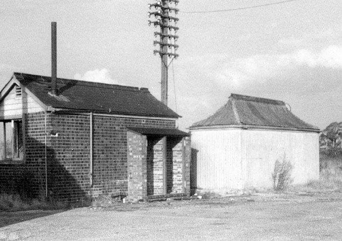
A mid 1960s close up view of the rear of Lechlade's disused signal box and the adjacent pagoda hut. The signal box's ATC battery box extension (now minus the doors) can be clearly seen. Martin Loader Collection
Lechlade station building seen from the approach road on 2 September 1959. The toilet block is on the left, the small window giving light to the ladies toilet. The first window in the
main building was for the ladies waiting room, followed by the main waiting room. The doors in the centre of the building opened directly into the main waiting room. The next two windows (both with bars) are for the office
and parcels store respectively. The back of the signal box can be seen between the station building and the pagoda hut. The cupboard like extension on the rear of the box housed the ATC equipment and batteries.
As in the previous picture, an air of desertion already exists here.
Colour Rail
Very few colour pictures have come to light showing the Witney to Fairford section after the cessation of train services but before removal of the track. However, this rather poor quality
picture of Lechlade station on 30 June 1963 shows the line one year after closure. Apart from some forty gallon drums and tyres on the platform, not a lot seems to have changed, although a caravan has appeared behind the
signal box and there appears to be some kind of mast, or possibly borehole drill erected behind it. Does anyone know what this was for?
Colour Rail
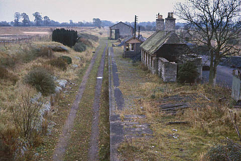
Over three years later in late 1966, the track has gone and the platform is becoming choked with grass. At this time the trackbed was clearly used by farm vehicles, as prior to the
building of the housing estate on the other side of the A361, this must have been a convenient route between fields, avoiding the main road. Although having not been tended for several years, the elaborate garden opposite
the platform is still just about holding out against the rough grass. In the background the field on the left has been cleared for gravel extraction, and the resultant lake has already started to form.
Tony Doyle
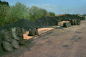
On 19 April 1980 (above left), the station site was still being used as a coal yard, with sacks of coal stacked on the concrete base of the corrugated iron pagoda hut. Shortly
afterwards, the site was abandoned, and nature quickly took over. In this view from 19 May 1992 (above right) the vegetation is starting to gain the upper hand. During the late 1990s the area had become an impenetrable
jungle.
Martin Loader
In 2003 the whole site was cleared of all vegetation and a new fence erected alongside the road. The concrete topped fuel tank stands in
glorious isolation in this 24 August view. Various other sections of masonry and assorted railway came to light during this clearance. All this has now disappeared under the Old Railway Close housing development. The housing estate, which was built in 2015, has completely
covered the entire station site. Martin Loader
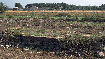
This view, taken on 24 August 2003, shows the remains of the platform with the road bridge just visible behind the tree in the background. The newly erected fence alongside the road
can also be seen. New houses were built some years ago on the other side of the road, and presumably the recent clearance operations herald the end of the station's existence. However, over three years after the clearing
operations nothing has happened, and nature is already starting to gain the upper hand again! No work can begin until the road bridge is demolished due to safety concerns over the junction into any new development.
Martin Loader
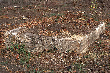
The extensive clearance operations in August 2003 revealed the layout of the station after years of being hidden under dense vegetation. This view shows the base of the goods shed.
Lechlade had a very spacious goods yard - the area behind the goods shed in this view only contained one siding. The picture was taken from the bank on the north side of the line, and is looking towards Manor Farm in the
distance.
Martin Loader
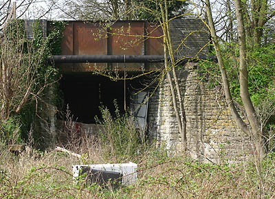
Lechlade road overbridge pictured on 22 April 2006. The new housing development on the other side of the bridge has resulted in a fence being erected, blocking off the other side
of the bridge. This has obviously been seen as too good an opportunity to miss, and so a second lower fence has been erected on this side (just visible behind the bushes) and the resultant void used as a handy dumping
ground for domestic and builder's rubbish.
Martin Loader
The structural integrity of Lechlade bridge seemed a little in doubt, when you examine this view of the underside of the span seen on 22 April 2006. At sometime in the bridge's life
the original rolled joists and timber decking were replaced with these reinforced concrete sections. However, ingress of water has rusted the reinforcing rods and consequent expansion is splitting off large junks of
concrete. Although not dangerous yet, this would only get worse, and when you consider that the road above is the A361 which carries a high volume of heavy traffic, it was no surprise that it was demolished and filled in when the adjacent new housing estate was built in 2015.
Martin Loader
Immediately after the A361 road bridge there is now new housing developments on both sides of the line, effectively obliterating the route. The straight line where the
gardens of the more recent houses on the north abut the houses on the south marks the course of the route. Less than ¼mile from the A361 bridge (SP215006) the houses on the north of the line give way to the
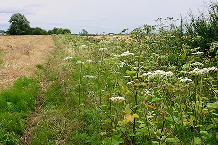
Gloucestershire Wildlife Trust's Edward Richardson nature reserve. This is another former gravel pit, now a haven for birds and other wildlife. A couple of footpaths cross the route here (SP213006 and SP212006).
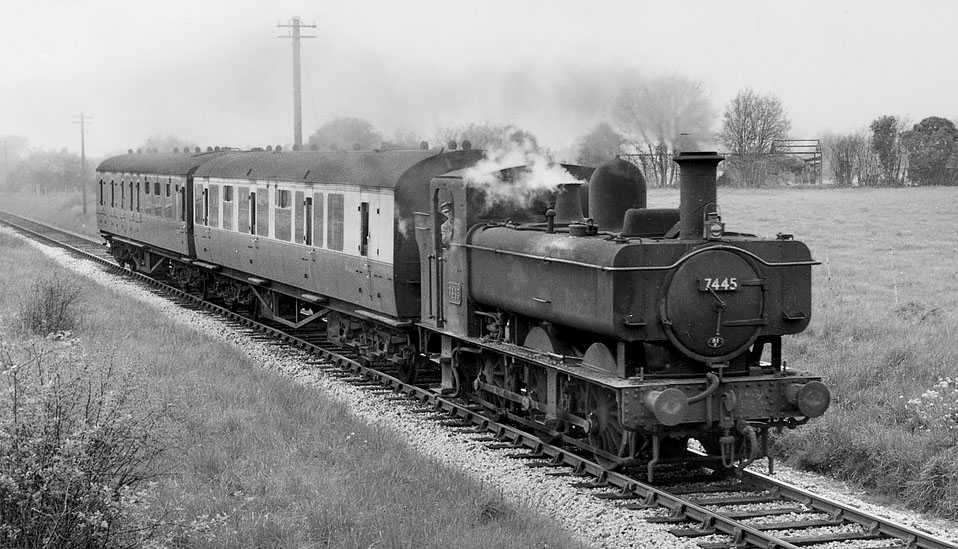
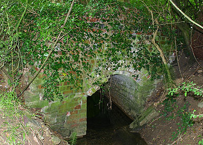
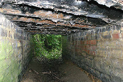
Approximately ½ mile after leaving Lechlade station, the line passed under another of the characteristic EGR bridges (SP210006), referred to in the GWR bridge survey as Hambridge
Road, Bridge No.26. This is the view looking west from the bridge in April 1961,
with 74xx 0-6-0PT 7445 approaching with a Fairford to Oxford train. Bob Brown
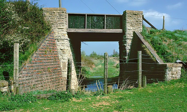
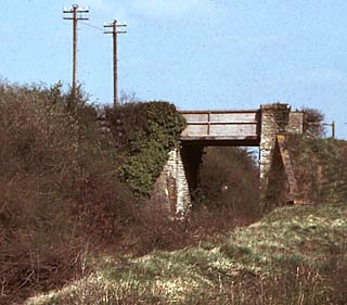
Hambridge Road bridge, pictured on 19 April 1980.The track has gone but the flood remains! This view is looking back towards Lechlade. The road is currently called Hambridge Lane and is part of the old Salt Way, the medieval trackway used for the transportation of salt from Cheshire to the Thames at Lechlade. The bridge has a span of
12ft 8in (13ft 3in on the skew). Martin Loader
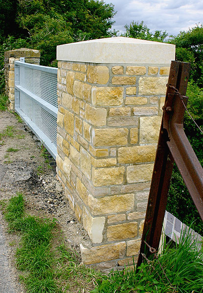
This bridge still survives, and the approach road doesn't seem to be suffering quite so much subsidence trouble as many of the others. In fact, as this picture taken on 16 July 2008
shows the bridge has recently had some significant repair work carried out. The former corrugated iron sides have now been replaced by a mesh screen, and in addition to repair work on three of the stone parapet ends, the one
on the south west corner has been completely replaced. Apart from the fact that the capstone is concrete rather than the original stone, it is an excellent job, and no doubt once it has weathered
it will be a perfect match.
This is a surprisingly busy road, considering it only leads from Lechlade to the villages of the Coln Valley. Obviously the structure of the bridge was considered to be sound enough to warrant repair work rather than
demolition, which would probably also have entailed realigning the road at this point to remove a noticeable double bend. Note the retention of the former railway fencing on the right. Martin Loader
Continuing westwards from the Hambridge Lane bridge the railway has been incorporated into the fields, as can be seen here at the point where another footpath crosses the line
(SP204007). This view is looking east along the hedgerow on 16 July 2008. The field on the left
has been extended over the railway. Presumably the removal of many tons of ballast was considered worthwhile for the small
increase in field acreage. Martin Loader
Although all trace of the line has been obliterated adjacent to the footpath
crossing mentioned earlier, the bridge over the stream (SP204007) survives in its original condition. However, as these views from 16 July
2008 show it may well not survive much longer. Although the north side of the bridge is in good shape (upper picture), the same cannot be said for the south side (lower picture). Although not immediately obvious from
this picture, the whole side of the bridge above the arch is leaning outwards at an alarming angle, due to the root growth of a tree that is growing on the track bed. It can only be a matter of time before the whole
section comes crashing down into the stream. As this will obviously block the watercourse and lead to flooding of the neighbouring fields, it is inevitable than when this happens this original structure will be replaced
by the ubiquitous concrete pipe. The creeping roots of the ivy have not helped either, as the outer bricks of the lower arch ring have already disappeared, except for the few at the left side, which are also on the point
of falling into the water! Martin Loader
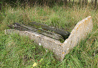
A short distance further on, the remains can be seen of one of the concrete ballast bins that were placed at intervals along the line to assist with local manual ballast packing.
Constructed from four concrete sections bolted together, these bins have all the hallmarks of emanating from the former Southern Railway's concrete works at Exmouth Junction. Two sides had disappeared by the time this
picture was taken on 14 August 2004.
Martin Loader
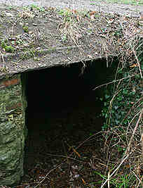
The course of the line is now running virtually due east, and soon crosses another stream (SP194008) on a rebuilt bridge that has consequently lost its original Barlow rail decking.
The farm buildings of Claydon Field can now bee seen on the left. A further ½ mile brings us to one of the more interesting relics of the line
surviving into the 21st centuary.
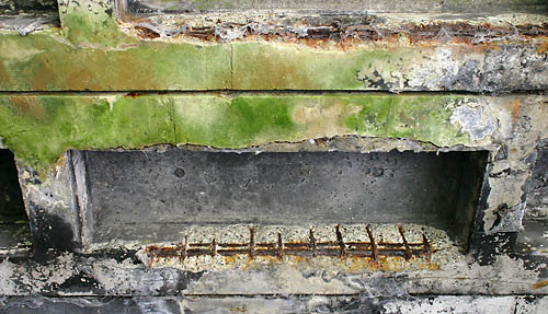
As mentioned on the Cassington page, Barlow rail was used on a number of Fairford branch bridges. These distinctive inverted V shape rails can still be seen in the decking of the
bridge over the stream approximately 2 miles west of Lechlade station (SP187009). These views taken on 6 December 2003 and 14 August 2004 show (left) Barlow rail visible on the edge of the 4ft wide bridge, and (right) the
heavily corroded Barlow rail decking viewed from the underside of the bridge. Continuing westward, the course of the line is discernable until the public footpath from the A361 crosses (SP181010), thereafter the line has
been incorporated into a large field, reappearing again when it crosses another small stream (SP176011) and enters a heavily overgrown section.
Martin Loader
The road bridge carrying the Whelford to Southrop minor road over the line (SP173011) is the
most westerly surviving structure on the line. When pictured on 19 April 1980, it still had wooden
parapets, however, now it has rather makeshift modern rail and wire parapets. This view
is now impossible due to rampant bush growth. From this bridge the line curves slightly to the south on the approach to the site of
Fairford Station.
Martin Loader